Enjoying the Helvellyn Walk via Striding Edge and Swirral Edge, a Lake District Classic
Author
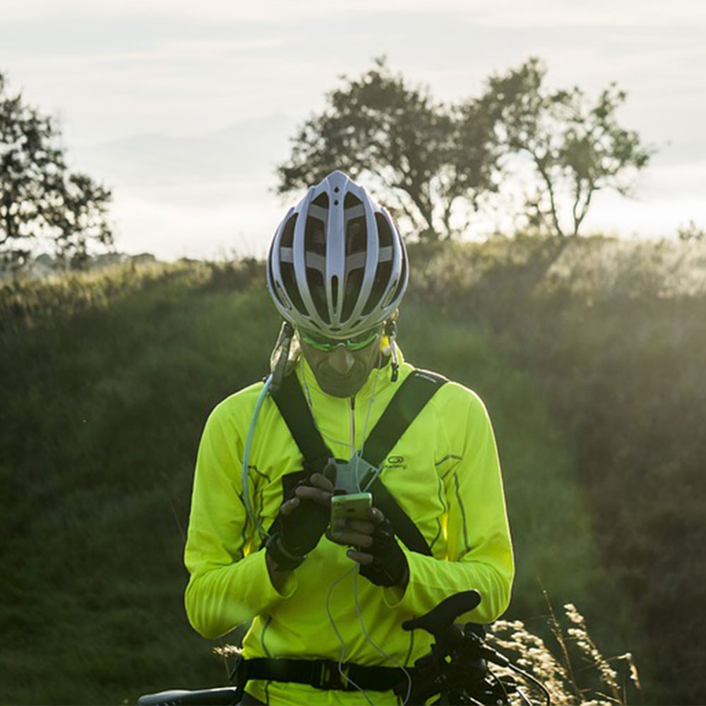
Chris shares his passion for cycling, hiking, skiing, and climbing from Buxton, in the Peak District. As a blogger for Outdoor Look, Chris shares outdoor tips and indoor tricks to help you get the most out of your time spent outside. When he's not out adventuring he's making videos or trying to keep up with his 4-year-old son.
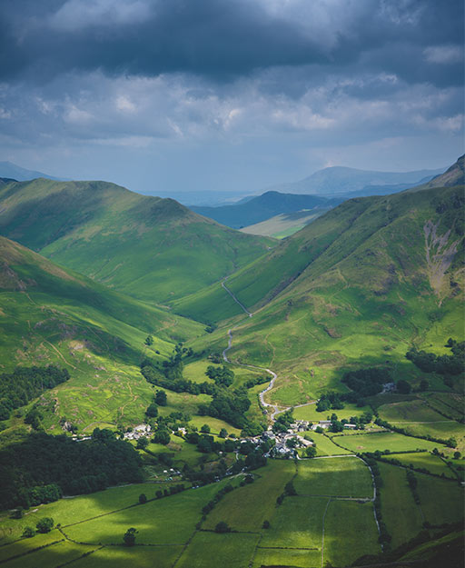
One of the most popular lakes, the Helvellyn Lake is a must-see route with beautiful edges and the Red tarn across the edge looking through the Ullswater Lake.
There are many people who walk every year through this place and although it is not higher than the Scafell Pike, it is a much better and exhilarating walk. It is also due to the ridge route of Striding Edge, which might look very imposing but is a great challenge. You can descend via the Swirrel Edge which is another ridge that might require you to use hand sin parts.
Helvellyn walk can be explored on a good day walking with your friends and family. If you are looking for answers as to how far is Helvellyn, how high is Helvellyn, etc. here is the list of answers that this blog would be able to offer:

- How long does it take to walk Helvellyn?
The full walk is around 4 to 5 hours depending on the route. If the route is via Striding Edge, the walk would definitely be 4-5 hours. There are different ways to descend.
- How many miles are there in Helvellyn Walk?
Depending upon the route, the most popular walk is around 7 miles in length, if you measure it from Glenridding or Patterdale.
- How high is Helvellyn?
It is 950m in height and is the third highest mountain in England after the Scafell Pile which stands at 978 meters and Sca Fell which stands at 964 meters.
- Is the place perfect for beginners?
It might look very imposing, but the people who have a reasonable level of fitness would not mind using their hands to reach the summit. Although it is advised that it could get dangerous during rainy conditions.
Overview:
Walk distance: 6.9 miles
Walk time: 4 hours 45 minutes
Walk difficulty: Hard
Depending upon the challenge that could be attained, the walk can be explored during favourable weather conditions as well as rainy weather as well as snowy or icy conditions.
Route Map
One of the most exhilarating and shortest ways to tackle Helvellyn, the Helvellyn walking route starts from Patterdale Hall which is the starting point for tackling Striding Edge. After some scrambling, you would be able to see the mesmerising views and you will be able to loop around the Red Tarn and descend via Swirral Edge to return back the same way.
It took us around five hours in total with plenty of stops. You can view the full interactive OS map through the Ordnance Survey. The Phone Map App is recommended to keep track of poor visibility.
Conclusion
There are many places to look for while exploring the place, including the centre of Geisedale Valley. The Nethermost Pike is a long walk through the place.
You will also meet many people getting ready to tackle the Striding Edge from the left, than the centre. You can see that scrambling is required after the walk till Striding Edge to the summit of Helvellyn.
People who have never walked the route will not know how tough it is. There are easier routes which can be seen along the side that can also be explored by people who are reasonably fit and have some experience in hiking.

Author
Chris shares his passion for cycling, hiking, skiing, and climbing from Buxton, in the Peak District. As a blogger for Outdoor Look, Chris shares outdoor tips and indoor tricks to help you get the most out of your time spent outside. When he's not out adventuring he's making videos or trying to keep up with his 4-year-old son.
- Speed Up Your Post-Hike Recovery with These 6 Essential Tips
- Cycling through Tranquil Roads and Coastal Views on the Isle of Wight
- The Essential Guide to Hiking Safety: 5 Tips Every Hiker Should Know
- Run Smart, Run Strong: Your Guide to Injury-Free Running
- Embrace Biking: Essential Tips for Beginners
Categories
- Sport (28)
- Product Reviews (3)
- Team Outdoor Look (7)
- Mike Wild (2)
- Mike Payton (2)
- Suse Hammond-Pears (3)
- Snowboarding (12)
- Latest Offers (105)
- Shop Talk (1)
- Competitions (7)
- Walking (413)
- Lifestyle Fashion (8)
- Travel (86)
- Kit Guides (176)
- Workwear Clothing (6)
- Safety Workwear (4)
- Health/Fitness (289)
- Skiing (91)
- Great Outdoors (1316)
- Cycling (92)
- January 2025
- December 2024
- November 2024
- October 2024
- September 2024
- August 2024
- July 2024
- June 2024
- May 2024
- April 2024
- March 2024
- February 2024
- January 2024
- December 2023
- November 2023
- October 2023
- September 2023
- August 2023
- July 2023
- June 2023
- May 2023
- April 2023
- March 2023
- February 2023
- January 2023
- December 2022
- November 2022
- October 2022
- September 2022
- August 2022
- July 2022
- June 2022
- May 2022
- April 2022
- March 2022
- February 2022
- January 2022
- December 2021
- November 2021
- October 2021
- September 2021
- August 2021
- July 2021
- June 2021
- May 2021
- April 2021
- March 2021
- February 2021
- January 2021
- December 2020
- November 2020
- October 2020
- September 2020
- August 2020
- July 2020
- June 2020
- May 2020
- April 2020
- March 2020
- February 2020
- January 2020
- December 2019
- November 2019
- October 2019
- September 2019
- August 2019
- July 2019
- June 2019
- May 2019
- April 2019
- March 2019
- February 2019
- January 2019
- December 2018
- November 2018
- October 2018
- September 2018
- August 2018
- July 2018
- June 2018
- May 2018
- April 2018
- March 2018
- February 2018
- January 2018
- December 2017
- November 2017
- October 2017
- September 2017
- August 2017
- July 2017
- June 2017
- May 2017
- April 2017
- March 2017
- February 2017
- January 2017
- December 2016
- November 2016
- October 2016
- September 2016
- August 2016
- July 2016
- June 2016
- May 2016
- April 2016
- March 2016
- February 2016
- January 2016
- December 2015
- November 2015
- October 2015
- September 2015
- August 2015
- July 2015
- June 2015
- May 2015
- April 2015
- March 2015
- February 2015
- January 2015
- December 2014
- November 2014
- October 2014
- September 2014
- August 2014
- July 2014
- June 2014
- May 2014
- April 2014
- March 2014
- February 2014
- January 2014
- December 2013
- November 2013
- October 2013
- September 2013
- August 2013
- July 2013
- June 2013
- May 2013
- April 2013
- March 2013
- February 2013
- January 2013
- December 2012
- November 2012
- October 2012
- September 2012
- August 2012
- July 2012
- June 2012
- May 2012
- April 2012
- March 2012
- February 2012
- January 2012
- December 2011
- November 2011
- October 2011
- September 2011
- August 2011
- May 2010
- April 2010
- March 2010
- February 2010
- January 2010
- November 2009
- October 2009
- September 2009
Submit a Comment