A Guide to Plan the Perfect Coast-to-Coast Walk
Author

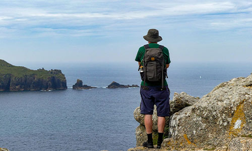
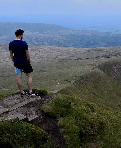
The coast-to-coast walk is a popular long-distance walking route in England. With 192 miles of distance, the route crosses the country coast to coast, starting at St Bees Head in Cumbria and finishing at Robin Hood's Bay in Yorkshire. It's a great way to see the country, get some exercise, and clear your head. But it's not something you just wake up one day and do. It takes months of planning, preparation, and training.
I did a lot of research before undertaking this journey. I read books and articles, spoke to people who had done the walk, and meticulously planned my route and accommodation. In this blog post, I'm going to share with you everything I learned in the hope that it will help you if you're planning on doing the walk yourself.
Choose your route
There are several long-distance trails that crisscross the country, so you'll need to decide which one is right for you. Consider factors like climate, scenery, difficulty, and length when making your decision. Once you've settled on a route, map out your proposed itinerary and make sure you have an exit strategy in case of emergencies.
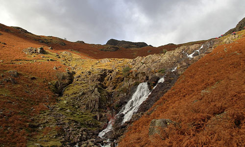
I chose the most popular route, which starts at St Bees Head in Cumbria and ends at Robin Hood's Bay in Yorkshire. This route takes you through some of England's most stunning scenery, including the Yorkshire Dales National Park and Lake District National Park.
Make your travel arrangements
One of the most important things to do when planning your Coast to Coast walk is to map out an itinerary. This will help you determine how long it will take you to complete the walk and book your accommodation accordingly. It's also a good idea to have a backup plan in case you get injured or need to take a break for any other reason.
Once you've decided on your start and end points, it's time to start thinking about accommodation and transport. If you're planning on walking the entire route, you'll need to book accommodation along the way. There are plenty of hostels, such as YHA Ennerdale, YHA Honister Hause, and Keld Bunkhouse, available along the route, so finding somewhere to stay shouldn't be a problem.
As for transport, you'll need to arrange how you're going to get to your start point and back from your endpoint. If you're driving yourself, you'll need to think about where you're going to leave your car during the walk. If you're using public transport, you'll need to check train and bus timetables in advance.
Coast-to-Coast transportation
If you're not starting from Cumbria or Yorkshire, you'll need to get transport to/from those locations. There are plenty of bus and train services that run between major cities in England (e.g., London, Manchester, and Birmingham).
You can rely on guidebooks and maps
I would highly recommend getting a guidebook (I used A Coast To Coast Walk) and a map (I used OS Explorer OL19) before starting your walk. These will be invaluable resources throughout the journey. You can buy them online or from most major bookstores in England.
Work on your map and compass skills
Finally, it's important that you learn to read a map and use a compass before embarking on your journey. This skill will come in handy if you get lost (which is bound to happen at some point). There are plenty of resources available online that can teach you how to use a compass (e.g., YouTube videos and blog posts). Alternatively, some outdoor stores offer classes on map reading and compass usage.
A coast-to-coast walk is an incredible experience that everyone should try at least once in their life. We hope these tips have helped give you some ideas about how to plan your own perfect coast-to-coast walk! Just remember to be patient, research in advance, pack light but carefully, and enjoy yourself.

-
 Regatta Unisex Ultralite 2 Pack Lightweight Walking Pole£23.40RRP £40.00 Save Up To £16.60
Author
Submit a Comment